Sheikh Zayed City Extension
Project Description
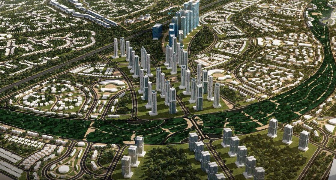
The project covers the strategic plan and development strategy of Sheikh Zayed City Extension, which stretches over an area of 8,500 feddans, including an area of 1,800 feddans for a preparatory phase covering top-priority segments of the extension. The strategic plan and development strategy ensure optimal land uses within the area and its territorial elements. They are integrated with the overall strategic plan of Sheikh Zayed City and 6th of October City.
The projects of the strategic plan aim to:
• Establish an attractive and functional layout meeting the housing needs of the increasing residents of Giza Governorate
• Foster residential communities and boost investments in Greater Cairo
• Establish an integrated urban environment and multifunctional developments, with proportional
distribution of residential and other land uses
Work covers a variety of activities:
• Performing data collection in coordination with relevant government authorities
• Studying and analyzing the current situation of economic activities, in terms of macroeconomic
fundamentals, land uses, size of investments, development opportunities, demand for urban and
residential activities, problems and obstacles to development, illegal land seizures, and role of Sheikh
Zayed extensions within the Investment Map adopted by the government
• Studying and analyzing transportation and infrastructure networks (water, sewage, telecommunications, electricity, gas, etc.), and identifying environmental resources, energy sources,
and electric power transmission mechanisms, with SWOT analyses for study sectors
• Identifying urban development trends, goals, and objectives, and selecting an optimum scenario of
urban development to establish an investment hub to the west of Cairo
• Preparing a strategic urban development plan and urban planning alternatives; selecting the optimum
alternative; and identifying top-priority projects to implement the required development strategy
• Preparing a strategic economic development plan, including plans for infrastructure networks, public
services, transportation, public transport, and conservation of natural resources (energy and water)
• Outlining land uses in light of development indicators; identifying the requirements of housing projects and associated services; defining the implementation stages of top-priority projects; proposing urban patterns; determining the physical configuration of central areas; and specifying the structural requirements for the extension’s areas
• Conducting economic studies; preparing a proposal on the best systems that can be utilized to encourage investments; and preparing an investment guide for top-priority projects
• Preparing a detailed master plan showing land use zoning, public services, landscaping, and various
other project components, and identifying building regulations for all land uses and project components
• Preparing detailed design drawings and tender documents for infrastructure networks
- Client
New Urban Communities Authority (NUCA)
- Location
- Sector
- Project Status
Completed
- Share This Project